Southwest Orlando rewards anyone who steps off the pavement of the city and onto its green corridors. The region blends lakeside calm, tree-covered avenues, and long, paved paths that invite both walkers and cyclists to move without traffic noise.
The geography here stretches from Winter Garden through Oakland and Windermere, across the growing neighborhoods of Horizon West, and westward into Clermont, where Lake County’s hills rise from the lake edge.
It doesn’t matter if your goal is a short evening stroll or a 40-mile weekend loop; the routes in this corner of Central Florida cover every mood and fitness level.
How to Use This Guide
The area’s trail system fits nearly everyone:
- Casual walkers and strollers who want shaded, car-free paths
- Families looking for easy, scenic miles with safe crossings
- Road and gravel cyclists chasing fitness mileage or endurance rides
- Birders and hikers seeking quiet corners with rich wildlife
Top Paved Greenways for Biking and Walking
Southwest Orlando’s paved greenways connect lakeside towns, neighborhoods, and parks in one smooth network.
They’re built for easy movement, perfect for anyone who wants steady miles without car traffic or rough terrain.
West Orange Trail
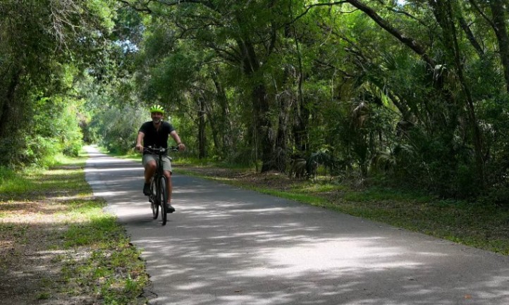
The West Orange Trail defines the biking culture of southwest Orlando. Its 22-mile route from the Lake County line to Apopka runs on smooth asphalt wide enough for two-way traffic, shaded in many parts by live oaks.
Orange County lists the official distance at 22.32 miles , with four main trailheads offering parking, restrooms, and maps.
Trailheads and Facilities
- Killarney Station (Oakland) – connects directly to South Lake Trail
- Winter Garden Station (455 E Plant St) – downtown amenities, rentals, restrooms
- Chapin Station (501 Crown Point Cross Rd) – restrooms, picnic tables, parking
- Apopka Station (111 S Forest Ave) – restrooms and maps for northern users
Helmet rule: Required for riders under 16 by county ordinance
Why It Stands Out
- Scenery: Historic Winter Garden’s core is lined with canopies and brick storefronts. Beyond town, the trail threads through suburban neighborhoods toward Apopka.
- Culture: Downtown Winter Garden is designated as a Trail Town , filled with coffee shops, bakeries, and repair stations only steps from the path.
- Connectivity: Killarney Station ties the route directly into Lake County’s South Lake Trail , expanding your reach toward Clermont and the statewide Coast-to-Coast Trail Corridor .
Best Segments
| User Type | Recommended Section | Distance | Notes |
| Families, casual riders | Winter Garden Station → Oakland | ~5 mi | Flat, shaded, food stops |
| Fitness cyclists | Killarney → Apopka | ~20 mi | Long stretches, fewer stops |
South Lake Trail (Clermont Connection)
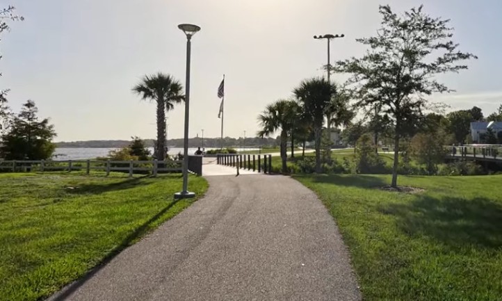
Rolling west from Killarney Station, the South Lake Trail begins where the West Orange ends. It hugs the northern shore of Lake Minneola and cuts through downtown Clermont and Minneola.
The lake views are constant, and the amenities: water fountains, shaded benches, showers at Waterfront Park , make it a comfortable long ride.
- Distance: About 22.6 miles in the regional corridor plan
- Surface: Smooth asphalt
- Key amenities: Restrooms, showers, shaded benches, water fountains, parking
Clermont markets itself as the midpoint of Florida’s Coast-to-Coast Trail , linking riders to the Van Fleet State Trail farther west. For southwest Orlando locals, this connection transforms a Winter Garden coffee ride into a half-day adventure with a lake swim at the turn-around.
Pro Tip: Start early. The lakefront sections get hot and open by midday. Use Waterfront Park’s shaded pavilion for your break.
Best Nature Hikes and Mixed-Surface Routes
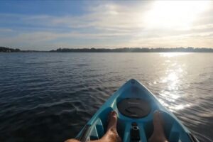
Southwest Orlando’s natural side goes beyond pavement. Around its lakes and preserves, soft-surface trails wind through pine flatwoods, sandhills, and wetlands that reward anyone who prefers quiet steps to busy bike lanes.
Lake Apopka Loop Trail
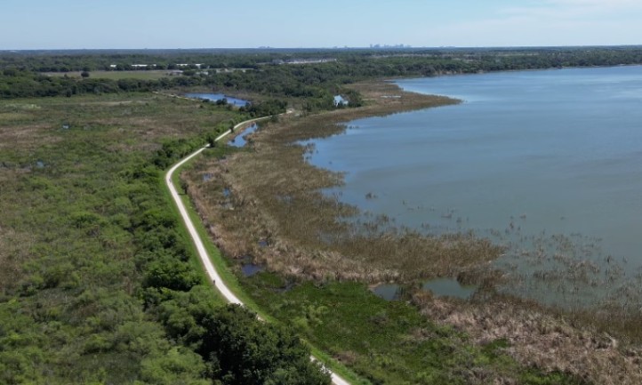
For gravel riders, birders, and early risers, Lake Apopka Loop Trail feels wild compared to the polished greenways. It traces the north shore of Lake Apopka , running atop levees that separate wetlands from open water.
The St. Johns River Water Management District manages the route and maintains clear access rules.
Quick Facts
| Detail | Information |
| Distance | 17–18 miles one way (~34 round trip) |
| Surface | Hard-packed shell and gravel |
| Shade | Very limited |
| Access Points | Green Mountain Overlook, Magnolia Park, North Shore, Clay Island |
| Hours | Daylight only |
What You’ll See
- Birdlife: One of Florida’s top birding corridors, home to over 360 species.
- Views: From the Green Mountain Scenic Overlook , the panorama of Lake Apopka stretches for miles. Riders descend switchbacks—rare in Florida—onto the levee system.
- Terrain: Long, straight sections with light grades. Gravel or hybrid tires (32–40 mm) handle it best.
Rider Tips
- Bring at least two bottles of water. There are long gaps without refill points.
- Cell service is good on high levees but can drop in low areas.
- Carry a flat-repair kit. The crushed shell surface can be sharp.
Nearby, the Lake Apopka Wildlife Drive (for cars) is open only on Fridays, Saturdays, Sundays, and holidays, but cyclists can use the levee trails daily.
Tibet-Butler Preserve
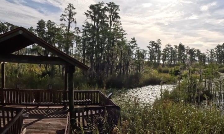
Hidden behind Windermere’s suburban streets, the Tibet-Butler Preserve is quiet, shaded, and limited to hikers only.
The short loops wind through pine flatwoods and cypress wetlands, with sections of raised boardwalks. It’s managed by Orange County’s Environmental Protection Division.
- Distance: 3.6 miles of loops
- Hours: Typically 8 a.m. to 6 p.m.
- Access: 8777 Winter Garden-Vineland Rd, Orlando
- Facilities: Restrooms, parking, and the Vera Carter Environmental Center
Pets and bikes are not permitted. It’s ideal for families or anyone seeking a break from traffic noise.
Oakland Nature Preserve
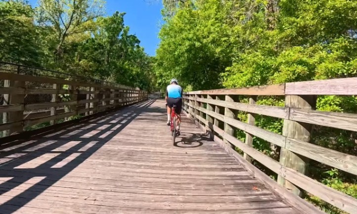
Just off the West Orange Trail near Oakland, the Oakland Nature Preserve adds an easy, scenic detour. Its boardwalk extends about two-thirds of a mile over wetlands to the edge of Lake Apopka, while upland trails loop through sandhill and oak hammock habitat.
- Access: 747 Machete Trail, Oakland
- Size: 150 acres
- Accessibility: Boardwalk is wheelchair friendly
- Extras: Nature center, educational programs, shaded picnic area
The preserve connects directly to the West Orange Trail, making it a perfect side stop for riders or walkers passing through Oakland.
Lake Louisa State Park
A few miles southwest of Clermont, Lake Louisa State Park changes the terrain completely. The park offers 20 miles of multi-use trails for hiking and off-road biking across rolling sandhills and lakeside forests. Elevation changes are noticeable, a rarity in Central Florida.
- Entry: State park fee applies
- Facilities: Campground, cabins, restrooms, parking
- Surface: Mostly unpaved, sandy soil mixed with hardpack
- Best for: Mountain bikes, hybrid tires, and anyone seeking quieter, longer trails
Bring bug spray and plenty of water. The park’s trail network can feel remote in midday heat.
Emerging and Connector Projects to Watch
View this post on Instagram
Southwest Orlando’s trail system keeps expanding through new links and resurfaced corridors. Several upcoming projects are set to connect existing routes and open safer, longer paths for both cyclists and walkers.
Shingle Creek Regional Trail
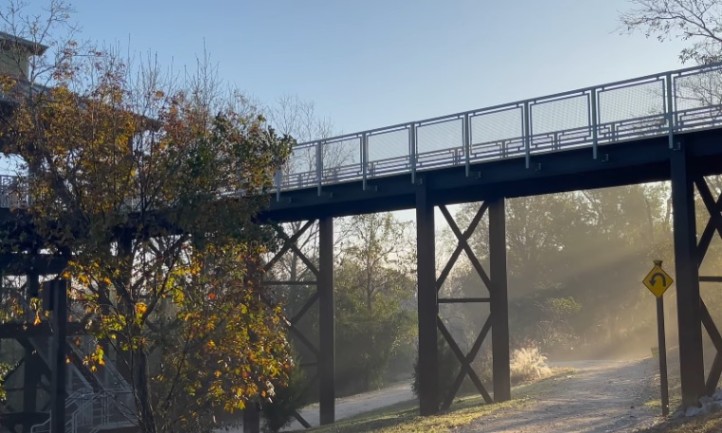
One of Central Florida’s most ambitious greenway projects, the Shingle Creek Regional Trail will eventually link Kissimmee to Wekiwa Springs , forming a continuous north–south spine through Orlando.
For southwest residents, the project means a protected route from the theme park corridor to the existing trail grid.
Key Facts
- Phase 3 extends from Town Loop Blvd along South John Young Parkway to the county line.
- Surface: 10–14 ft wide concrete path
- Purpose: Connects to West Orange, South Lake, Cross Seminole, and Seminole Wekiva trails.
When complete, it will let cyclists ride from Disney’s edge to Clermont or Apopka without using major roads. Orange County’s Parks & Recreation site posts current maps and segment updates.
Horizon West Regional Park Trails
The Horizon West area continues to grow its recreation network. The Horizon West Regional Park , spanning 215 acres , includes walking and equestrian paths, with more mileage under development.
It’s convenient for residents in Hamlin, Independence, and Lakeside Village who want natural-surface walking options without driving to the larger trails.
Access: Hamlin Groves Trail at Mann Rd, Winter Garden
Hours: Sunrise to sunset
Parking, Rentals, and Hours
Safety and Wildlife Etiquette
Florida’s wetlands come with native wildlife. Encounters are rare but possible. The state’s Fish and Wildlife Conservation Commission (FWC) provides clear rules for staying safe:
- Keep a wide distance if you see an alligator.
- Leash pets and keep them away from the water’s edge.
- Never swim in canals or retention ponds.
- Report nuisance alligators to the FWC hotline (866-392-4286) .
General Trail Etiquette
- Ride on the right, pass on the left, and give an audible signal when passing.
- Wear bright clothing and use lights during dawn or dusk hours.
- Obey all posted traffic controls at crossings.
- Trails close at sunset unless otherwise posted.
- Carry a phone, hydration, and ID for emergencies.
Two Half-Day Plans That Always Work
Not every ride has to fill a whole day. These two routes pack the best of southwest Orlando: scenery, rest stops, and smooth mileage, into half-day outings that fit any schedule.
Plan A: Coffee, Oaks, and Lakes on West Orange and South Lake
Start: Winter Garden Station
Grab coffee downtown and check tire pressure before heading west.
Ride: Follow West Orange Trail to Killarney Station, then continue onto the South Lake Trail. The shoreline of Lake Minneola offers wide open views and small hills perfect for endurance work.
Stop: Waterfront Park in Clermont for water, snacks, or a quick swim.
Return: Head back to Winter Garden for lunch. Expect 25–35 miles total , depending on your turnaround.
Ideal for: Fitness riders, groups, or anyone wanting a long but smooth loop.
Plan B: Sunrise at Green Mountain and the Loop Trail
Start: Green Mountain Scenic Overlook, just after dawn.
Watch the lake light up before descending onto the Lake Apopka Loop Trail .
Route: Choose east toward Magnolia Park or west toward the North Shore Trailhead. Both directions offer wildlife views and levee riding.
Return: Climb back to the overlook, cool down under the pavilion, and refuel at nearby cafes.
Ideal for: Early risers, gravel cyclists, photographers, and birdwatchers.
Quick Comparison Table
Where Beginners Should Start
- First bike ride: Winter Garden Station → Oakland and back. Flat, shaded, and lined with rest stops.
- First nature walk: Tibet-Butler or Oakland Nature Preserve boardwalk. Both short, family-friendly, and scenic.
- First endurance day: Killarney Station → Clermont and return. The South Lake Trail offers services, views, and gradual hills.
Trail Development and Long-Range Planning
Southwest Orlando’s trail network continues to evolve through Orange County Parks & Recreation and MetroPlan Orlando .
- Shingle Creek Regional Trail phases will eventually connect the theme park corridor north to existing routes.
- West Orange Trail planning includes potential extensions toward US-441 and new overpasses to remove at-grade crossings.
Riders who commute or train regularly should watch county project pages for construction updates and future links to Seminole County trails.
Final Pointers Before You Go
- Hydration: Carry more water than you think you need. Even shaded trails heat up by midmorning.
- Shade & Timing: Start early or ride late afternoon for cooler air.
- Wildlife Respect: Keep pets leashed and give space to alligators and wading birds.
- Check Hours: Trails close at sunset, except where park rules specify otherwise.
- Lights & Gear: Front and rear lights help visibility at dawn or dusk.
- Crossings: Slow down and make eye contact with drivers at intersections.